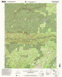
2001 Map of Crandall Peak
USGS Topo · Published 2004About this map
The Middle Fork Stanislaus River carves a deep path through the center of this terrain, marking a landscape defined by significant timber resources and water management. To the north, the Calaveras Big Trees State Park preserves the notable groves near Sugar Pine Gap, while the Tuolumne State Game Refuge covers a massive portion of the central forest. The infrastructure of the early 21st century is evident in the presence of the Southern Powerhouse and Sand Bar Flat Dam along the river, illustrating the region's role in power generation.
Find a feature on this map
41 named features on this map. Tap any name to fly to it.
Don’t see what you’re looking for? This feature index may not catch every label — zoom into the map to look around manually.
Map Details
Editions of this 2001 Crandall Peak Map
This is the sole edition of this map. No revisions or reprints were ever made.
Other maps of this area

1891 · Big Trees
USGS Topo · 1:125,000

1894 · Big Trees
USGS Topo · 1:125,000

1897 · Big Trees
USGS Topo · 1:125,000

1901 · Big Trees
USGS Topo · 1:125,000

1947 · Sacramento
USGS Topo · 1:250,000

1948 · Sacramento
USGS Topo · 1:250,000

1948 · Columbia
USGS Topo · 1:62,500
1948 · Columbia SE
USGS Topo · 1:24,000

1948 · Stanislaus
USGS Topo · 1:24,000
1949 · Columbia SE
USGS Topo · 1:24,000