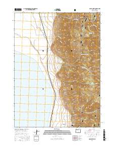
2017 Map of Crane Creek
USGS Topo · Published 2017About this map
New Pine Creek serves as a primary point of settlement along the eastern shoreline of Goose Lake in southern Lake County. The landscape here is defined by a dramatic transition from the high elevations of the Fremont National Forest down to the marshy edge of the lake. Descending from the heights of Sugar Peak, numerous drainages including Crane Creek, Cogswell Cr, and Kelley Cr carve through the terrain. Evidence of local history and family lineages is preserved at the New Pine Creek Cem, situated just north of the community. In the interior highlands, smaller water bodies such as Thunder Egg Lake are reached by forest routes like Natl Forest Develop Road 4110 Rd, while the valley floor is serviced by Cogswell Rd and Old Wells Rd. The mapping of townships t40s r20e and t41s r21e illustrates the intersection of public land management and rural agricultural habitation.
Find a feature on this map
25 named features on this map. Tap any name to fly to it.
Don’t see what you’re looking for? This feature index may not catch every label — zoom into the map to look around manually.
Map Details
Editions of this 2017 Crane Creek Map
This is the sole edition of this map. No revisions or reprints were ever made.
Other maps of this area

1886 · Alturas
USGS Topo · 1:250,000

1892 · Alturas
USGS Topo · 1:250,000

1954 · Alturas
USGS Topo · 1:250,000

1955 · Klamath Falls
USGS Topo · 1:250,000

1958 · Alturas
USGS Topo · 1:250,000

1958 · Klamath Falls
USGS Topo · 1:250,000

1962 · Alturas
USGS Topo · 1:250,000

1962 · Willow Ranch
USGS Topo · 1:62,500

1962 · Fort Bidwell
USGS Topo · 1:62,500

1964 · Lakeview NE
USGS Topo · 1:24,000