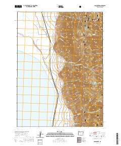
2020 Map of Crane Creek
USGS Topo · Published 2020About this map
New Pine Creek sits at the base of the high country, serving as a gateway between the eastern shore of Goose Lake and the steep rising slopes of the Fremont National Forest. This 2020 survey reveals a landscape where the transition from lakebed to mountain is sharp and immediate, defined by the drainage systems of Crane Cr, Cogswell Cr, and Tandy Cr as they flow westward toward the water. Local history and genealogy are anchored at the New Pine Creek Cem, situated just outside the small settlement near the California-Oregon border. Further into the interior, the map highlights topographical landmarks such as Sugar Peak and the curiously named Thunder Egg Lake, reflecting the region's volcanic geology. The road network, including Old Wells Rd and Natl Forest Develop Road 4110 Rd, provides a clear view of how land access is managed in this part of Lake County.
Find a feature on this map
25 named features on this map. Tap any name to fly to it.
Don’t see what you’re looking for? This feature index may not catch every label — zoom into the map to look around manually.
Map Details
Editions of this 2020 Crane Creek Map
This is the sole edition of this map. No revisions or reprints were ever made.
Other maps of this area

1886 · Alturas
USGS Topo · 1:250,000

1892 · Alturas
USGS Topo · 1:250,000

1954 · Alturas
USGS Topo · 1:250,000

1955 · Klamath Falls
USGS Topo · 1:250,000

1958 · Alturas
USGS Topo · 1:250,000

1958 · Klamath Falls
USGS Topo · 1:250,000

1962 · Alturas
USGS Topo · 1:250,000

1962 · Willow Ranch
USGS Topo · 1:62,500

1962 · Fort Bidwell
USGS Topo · 1:62,500

1964 · Lakeview NE
USGS Topo · 1:24,000