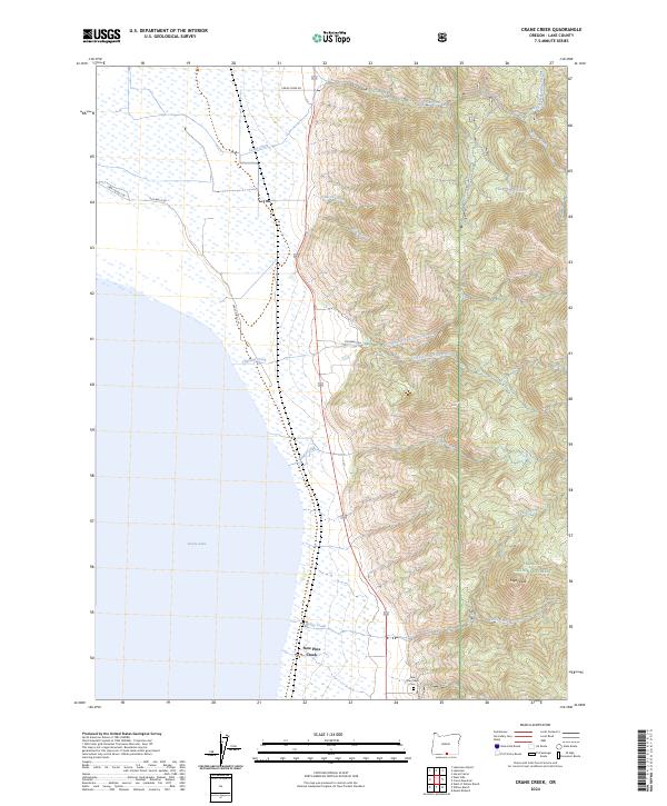
2024 Map of Crane Creek
USGS Topo · Published 2024About this map
Goose Lake dominates the western shoreline of this Lake County landscape, where the waters meet a complex drainage system flowing from the high ground of the Fremont National Forest. The settlement of New Pine Creek serves as a focal point near the southern margin, situated along the edge of the wetlands and served by the New Pine Creek Cem. The terrain rises sharply to the east, climbing toward Sugar Peak and several named drainages including Kelley Creek, Sugar Creek, and Tandy Creek.
Find a feature on this map
24 named features on this map. Tap any name to fly to it.
Don’t see what you’re looking for? This feature index may not catch every label — zoom into the map to look around manually.
Map Details
Editions of this 2024 Crane Creek Map
This is the sole edition of this map. No revisions or reprints were ever made.
Other maps of this area

1886 · Alturas
USGS Topo · 1:250,000

1892 · Alturas
USGS Topo · 1:250,000

1954 · Alturas
USGS Topo · 1:250,000

1955 · Klamath Falls
USGS Topo · 1:250,000

1958 · Alturas
USGS Topo · 1:250,000

1958 · Klamath Falls
USGS Topo · 1:250,000

1962 · Alturas
USGS Topo · 1:250,000

1962 · Willow Ranch
USGS Topo · 1:62,500

1962 · Fort Bidwell
USGS Topo · 1:62,500

1964 · Lakeview NE
USGS Topo · 1:24,000