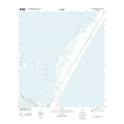
2013 Map of Crane Islands NW
USGS Topo · Published 2013About this map
Mustang Island dominates the eastern half of this coastal landscape, separated from the mainland and various smaller landforms like Demit Island and the Crane Islands by the waters of the Laguna Madre. The map illustrates a complex network of coastal waterways and cuts, including Wilsons Cut, Grants Cove, and the Corpus Christi Pass, which provide vital navigation between the bay and the Gulf of Mexico.
Find a feature on this map
29 named features on this map. Tap any name to fly to it.
Don’t see what you’re looking for? This feature index may not catch every label — zoom into the map to look around manually.
Map Details
Editions of this 2013 Crane Islands NW Map
This is the sole edition of this map. No revisions or reprints were ever made.
Other maps of this area

1925 · Aransas Pass
USGS Topo · 1:62,500

1925 · Oso Creek
USGS Topo · 1:62,500

1925 · Corpus Christi
USGS Topo · 1:62,500

1950 · Corpus Christi
USGS Topo · 1:250,000

1951 · Portland
USGS Topo · 1:24,000

1951 · Corpus Christi
USGS Topo · 1:62,500

1951 · Crane Islands NW
USGS Topo · 1:24,000

1951 · Oso Creek NE
USGS Topo · 1:24,000

1951 · Crane Islands SW
USGS Topo · 1:24,000

1951 · Oso Creek
USGS Topo · 1:62,500