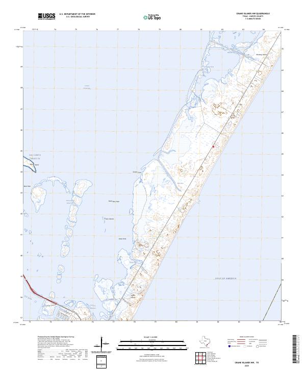
2025 Map of Crane Islands NW
USGS Topo · Published 2025About this map
Mustang Island and the northern tip of Padre Island dominate this coastal landscape, where the shifting sands of the Texas barrier islands meet the expanse of the Gulf of America. The map documents a complex aquatic environment defined by the Intracoastal Waterway and the various inlets and cuts that connect Corpus Christi Bay to the open sea. Natural and man-made water features such as Fish Pass, Packery Channel, and Wilsons Cut highlight the area's maritime importance. Along the western edge, the presence of NAS Corpus Christi TX on Demit Island indicates the strategic military value of this shoreline. Recreational and ecological interest is centered on the tidal flats and pools like Dead Man Hole and Kates Hole, while the modern road network, including S Padre Island Dr and Park Rd 22, provides access to these shifting barrier environments.
Find a feature on this map
26 named features on this map. Tap any name to fly to it.
Don’t see what you’re looking for? This feature index may not catch every label — zoom into the map to look around manually.
Map Details
Editions of this 2025 Crane Islands NW Map
This is the sole edition of this map. No revisions or reprints were ever made.
Other maps of this area

1925 · Aransas Pass
USGS Topo · 1:62,500

1925 · Oso Creek
USGS Topo · 1:62,500

1925 · Corpus Christi
USGS Topo · 1:62,500

1950 · Corpus Christi
USGS Topo · 1:250,000

1951 · Portland
USGS Topo · 1:24,000

1951 · Corpus Christi
USGS Topo · 1:62,500

1951 · Crane Islands NW
USGS Topo · 1:24,000

1951 · Oso Creek NE
USGS Topo · 1:24,000

1951 · Crane Islands SW
USGS Topo · 1:24,000

1951 · Oso Creek
USGS Topo · 1:62,500