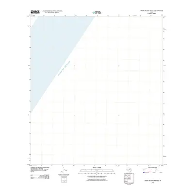
2010 Map of Crane Islands NW OE E
USGS Topo · Published 2010About this map
Gulf of Mexico waters dominate this coastal quadrangle off the shores of Corpus Christi, Texas. Produced by the U.S. Geological Survey in 2010, the map illustrates the maritime expanse of the Gulf during the early 21st century. The map is primarily comprised of open water, highlighting the bathymetry and nautical boundary of this portion of the Texas coastline without terrestrial landforms or settlements present on the sheet.
Find a feature on this map
1 named feature on this map. Tap any name to fly to it.
Don’t see what you’re looking for? This feature index may not catch every label — zoom into the map to look around manually.
Map Details
Editions of this 2010 Crane Islands NW OE E Map
This is the sole edition of this map. No revisions or reprints were ever made.
Other maps of this area

1925 · Aransas Pass
USGS Topo · 1:62,500

1950 · Corpus Christi
USGS Topo · 1:250,000

1951 · Crane Islands NW
USGS Topo · 1:24,000

1951 · Crane Islands SW
USGS Topo · 1:24,000

1951 · Crane Islands
USGS Topo · 1:62,500

1954 · Port Ingleside
USGS Topo · 1:24,000
1954 · Port Aransas
USGS Topo · 1:24,000

1954 · Aransas Pass
USGS Topo · 1:62,500

1956 · Corpus Christi
USGS Topo · 1:250,000

1960 · Corpus Christi
USGS Topo · 1:250,000