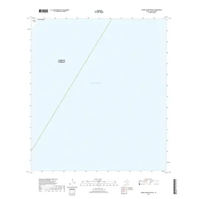
2019 Map of Crane Islands NW OE E
USGS Topo · Published 2019About this map
Mustang Island defines the narrow strip of terrestrial land in the northwestern corner of this 2019 survey, where the settlement of Port Aransas meets the open waters. Most of this coastal quadrant is occupied by the Gulf of Mexico, illustrating the expansive marine environment just off the Texas coast. The territorial boundaries of Corpus Christi extend into these waters, marking the city's maritime jurisdiction. The map provides a clear look at the relationship between the barrier island's edge and the deep gulf, a landscape primarily shaped by tidal forces and coastal management rather than dense inland development.
Find a feature on this map
5 named features on this map. Tap any name to fly to it.
Don’t see what you’re looking for? This feature index may not catch every label — zoom into the map to look around manually.
Map Details
Editions of this 2019 Crane Islands NW OE E Map
This is the sole edition of this map. No revisions or reprints were ever made.
Other maps of this area

1925 · Aransas Pass
USGS Topo · 1:62,500

1950 · Corpus Christi
USGS Topo · 1:250,000

1951 · Crane Islands NW
USGS Topo · 1:24,000

1951 · Crane Islands SW
USGS Topo · 1:24,000

1951 · Crane Islands
USGS Topo · 1:62,500

1954 · Port Ingleside
USGS Topo · 1:24,000
1954 · Port Aransas
USGS Topo · 1:24,000

1954 · Aransas Pass
USGS Topo · 1:62,500

1956 · Corpus Christi
USGS Topo · 1:250,000

1960 · Corpus Christi
USGS Topo · 1:250,000