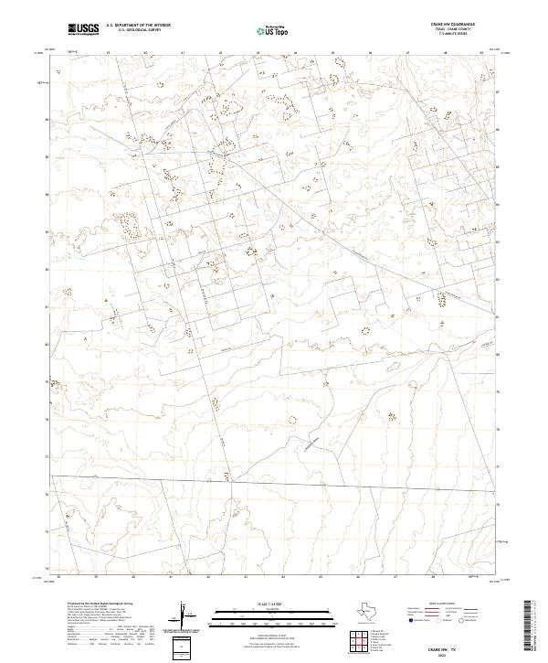
2022 Map of Crane NW
USGS Topo · Published 2022About this map
The West Texas landscape north of Crane is defined by its industrial road network and the gentle incision of ephemeral watercourses. The broad drainage of Landreth Draw trends across the lower half of the quadrangle, a significant terrain feature in this arid region. The map documents an extensive grid of service roads that reflect the area's role in the regional petroleum and energy sectors, including Arco Plant Rd, Arco Rd, and S Exxon Rd. These names provide a direct link to the corporate and logistical history of the Permian Basin, while roads like Sand Camp Rd and Dump Ground Rd mark localized landmarks and land use patterns. This 2022 survey captures the contemporary infrastructure of the oil fields, where rural routes like FM 1601 N connect industrial sites to the broader region.
Find a feature on this map
9 named features on this map. Tap any name to fly to it.
Don’t see what you’re looking for? This feature index may not catch every label — zoom into the map to look around manually.
Map Details
Editions of this 2022 Crane NW Map
This is the sole edition of this map. No revisions or reprints were ever made.
Other maps of this area

1928 · Crane
USGS Topo · 1:125,000

1954 · Pecos
USGS Topo · 1:250,000

1957 · Pecos
USGS Topo · 1:250,000

1964 · Doodle Bug Well
USGS Topo · 1:24,000

1964 · Penwell SE
USGS Topo · 1:24,000

1964 · Perkins Lake
USGS Topo · 1:24,000

1974 · Tubbs Corner
USGS Topo · 1:24,000

1974 · Crane SW
USGS Topo · 1:24,000
1974 · Crane
USGS Topo · 1:24,000

1974 · Juan Cordona Lake
USGS Topo · 1:24,000