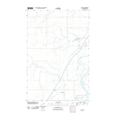
2011 Map of Crane
USGS Topo · Published 2011About this map
The Yellowstone River defines the eastern boundary of this agricultural landscape in Richland County, where the small community of Crane serves as a local hub. The map provides a detailed view of the infrastructure supporting the area, including the Crane Post Office and the nearby Crane Cemetery. The terrain is marked by numerous watercourses such as Crane Creek, Fox Creek, and Sears Creek that drain toward the river valley. To the west, the Gartside Reservoir and Gartside Dam highlight the management of local water resources for the surrounding prairie. Smaller named locations like Midway and Hoffmanville dot the rural road network, while the primary route connects the settlement of Crane with the broader region. This survey documents the persistent settlement patterns and water-dependent geography of eastern Montana in the early 21st century.
Find a feature on this map
20 named features on this map. Tap any name to fly to it.
Don’t see what you’re looking for? This feature index may not catch every label — zoom into the map to look around manually.
Map Details
Editions of this 2011 Crane Map
This is the sole edition of this map. No revisions or reprints were ever made.
Other maps of this area

1909 · Glendive
USGS Topo · 1:250,000

1954 · Glendive
USGS Topo · 1:250,000

1957 · Glendive
USGS Topo · 1:250,000

1958 · Glendive
USGS Topo · 1:250,000

1966 · Savage
USGS Topo · 1:24,000

1966 · Crane NE
USGS Topo · 1:24,000

1966 · Crane NW
USGS Topo · 1:24,000

1966 · Piche
USGS Topo · 1:24,000

1966 · Knife River Mine
USGS Topo · 1:24,000

1966 · Crane
USGS Topo · 1:24,000