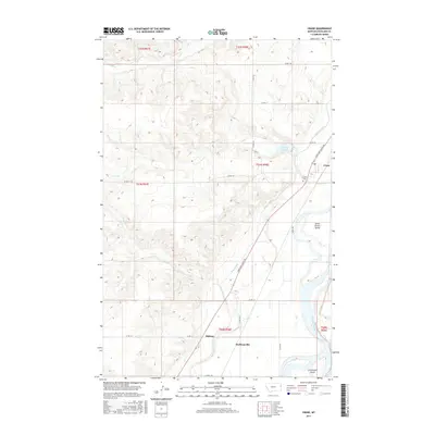
2017 Map of Crane
USGS Topo · Published 2017About this map
The Yellowstone River anchors this landscape in eastern Montana, carving a wide valley floor marked by landforms like Seven Sisters Island and Crittenden Island. In this 2017 study, the interplay between the natural river system and human engineering is evident through the prominent Main Canal, which parallels the river's course to support local agriculture. Small settlements such as Crane, Midway, and Hoffmanville dot the corridor along the Lewis and Clark Trl, reflecting the historical transport and irrigation patterns of Richland County. Genealogists and local historians can locate the Crane Cem situated near the drainage of Crane Cr, while the presence of Gartside Reservoir and several creek systems like Fox Cr and Sears Cr illustrate the managed hydrology of the plains. This map captures the area's transition from riverbed to upland bluffs, defined by a network of county roads including Co RD 118 and Co RD 115.
Find a feature on this map
28 named features on this map. Tap any name to fly to it.
Don’t see what you’re looking for? This feature index may not catch every label — zoom into the map to look around manually.
Map Details
Editions of this 2017 Crane Map
This is the sole edition of this map. No revisions or reprints were ever made.
Other maps of this area

1909 · Glendive
USGS Topo · 1:250,000

1954 · Glendive
USGS Topo · 1:250,000

1957 · Glendive
USGS Topo · 1:250,000

1958 · Glendive
USGS Topo · 1:250,000

1966 · Savage
USGS Topo · 1:24,000

1966 · Crane NE
USGS Topo · 1:24,000

1966 · Crane NW
USGS Topo · 1:24,000

1966 · Piche
USGS Topo · 1:24,000

1966 · Knife River Mine
USGS Topo · 1:24,000

1966 · Crane
USGS Topo · 1:24,000