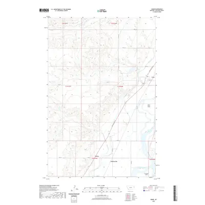
2020 Map of Crane
USGS Topo · Published 2020About this map
The Yellowstone River defines the eastern landscape of this Richland County region, where the braided river channel surrounds large landforms like Seven Sisters Island and Crittenden Island. The small settlement of Crane sits near the river's edge, served by the historical Lewis and Clark Trl. This corridor reflects the agricultural and irrigation development of the valley, highlighted by the prominent Main Canal winding through the terrain to support local homesteads. Inland from the river, the smaller communities of Midway and Hoffmanville are established among a network of county roads and coulees. Local genealogy and history are anchored at the Crane Cem, while the drainage systems of Crane Cr, Fox Cr, and Sears Cr illustrate the natural topography that dictated the placement of these early twentieth-century rural developments.
Find a feature on this map
28 named features on this map. Tap any name to fly to it.
Don’t see what you’re looking for? This feature index may not catch every label — zoom into the map to look around manually.
Map Details
Editions of this 2020 Crane Map
This is the sole edition of this map. No revisions or reprints were ever made.
Other maps of this area

1909 · Glendive
USGS Topo · 1:250,000

1954 · Glendive
USGS Topo · 1:250,000

1957 · Glendive
USGS Topo · 1:250,000

1958 · Glendive
USGS Topo · 1:250,000

1966 · Savage
USGS Topo · 1:24,000

1966 · Crane NE
USGS Topo · 1:24,000

1966 · Crane NW
USGS Topo · 1:24,000

1966 · Piche
USGS Topo · 1:24,000

1966 · Knife River Mine
USGS Topo · 1:24,000

1966 · Crane
USGS Topo · 1:24,000