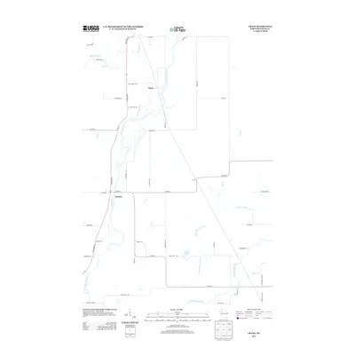
2013 Map of Crane
USGS Topo · Published 2013About this map
The Chippewa River carves a winding path through this portion of Rusk County, anchoring a landscape defined by its riparian corridors and rural crossroads. Small settlements such as Murry and Imalone sit along the river's western bank, connected by the primary north-south artery of State Road 40. To the east, the terrain becomes more complex as the Thornapple River and its tributary, the Little Thornapple River, thread through the countryside near the community of Crane. This area is characterized by a dense network of local roads named for early settler families, such as Berkeypile Rd, Godfrey Rd, and Scheel Rd. The map also details smaller water bodies like Bass Lake and creeks including Big Weirgor Cr and Flunkers Cr, illustrating the well-watered timber and agricultural lands of northern Wisconsin.
Find a feature on this map
47 named features on this map. Tap any name to fly to it.
Don’t see what you’re looking for? This feature index may not catch every label — zoom into the map to look around manually.
Map Details
Editions of this 2013 Crane Map
This is the sole edition of this map. No revisions or reprints were ever made.
Other maps of this area

1944 · Exeland
USGS Topo · 1:48,000

1945 · Meteor
USGS Topo · 1:48,000

1947 · Exeland
USGS Topo · 1:48,000

1948 · Weyerhauser
USGS Topo · 1:48,000

1948 · Ladysmith
USGS Topo · 1:48,000

1949 · Meteor
USGS Topo · 1:48,000

1950 · Weyerhauser
USGS Topo · 1:48,000

1950 · Ladysmith
USGS Topo · 1:48,000

1953 · Rice Lake
USGS Topo · 1:250,000

1959 · Rice Lake
USGS Topo · 1:250,000