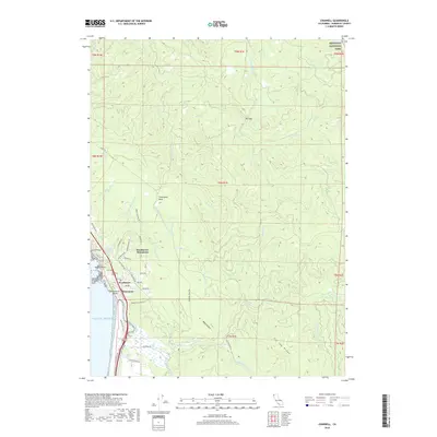
2018 Map of Crannell
USGS Topo · Published 2018About this map
Westhaven-Moonstone and Westhaven occupy the coastal terrace above the Pacific in this recent 2018 survey of the Humboldt County coastline. The landscape is defined by the drainage systems of the Little River and Luffenholtz Cr, which carve through the dense terrain as they flow toward the sea. To the north, a portion of Redwood National Park marks the protected forest land, while the coastal edge is defined by landmarks like Moonstone Beach, Sotsin Point, and the distinct Little River Rock. Local industry and transit history are subtly preserved in road names such as Railroad Ave and the Old RR Grade N, indicating the timber and transport networks that once dominated this region. Further inland, the map details many smaller tributaries including McConnahas Mill Cr and Eighteen Cr, reaching toward the prominent Tip Top Ridge.
Find a feature on this map
67 named features on this map. Tap any name to fly to it.
Don’t see what you’re looking for? This feature index may not catch every label — zoom into the map to look around manually.
Map Details
Editions of this 2018 Crannell Map
This is the sole edition of this map. No revisions or reprints were ever made.
Other maps of this area

1922 · Eureka
USGS Topo · 1:62,500

1922 · Korbel
USGS Topo · 1:62,500

1925 · Hoopa
USGS Topo · 1:125,000

1933 · Eureka
USGS Topo · 1:48,000

1942 · Eureka
USGS Topo · 1:62,500

1945 · Trinidad
USGS Topo · 1:62,500

1945 · Coyote Peak
USGS Topo · 1:62,500

1945 · Blue Lake
USGS Topo · 1:62,500

1948 · Weed
USGS Topo · 1:250,000

1949 · Eureka
USGS Topo · 1:250,000