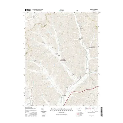
2016 Map of Cranston
USGS Topo · Published 2016About this map
Daniel Boone National Forest encompasses a significant portion of this landscape, where the ridges of Rowan, Fleming, and Lewis Counties meet. The area is defined by a dense network of hollows and family-named cemeteries, reflecting generations of settlement along the waterways of the North Fork Triplett Creek and its many tributaries. In the south, the community of Cranston sits at a junction of valley roads, while Smile and Waltz serve as small hubs for the surrounding homesteads.
Find a feature on this map
115 named features on this map. Tap any name to fly to it.
Don’t see what you’re looking for? This feature index may not catch every label — zoom into the map to look around manually.
Map Details
Editions of this 2016 Cranston Map
This is the sole edition of this map. No revisions or reprints were ever made.
Other maps of this area

1929 · Morehead
USGS Topo · 1:48,000

1929 · Salt Lick
USGS Topo · 1:62,500

1934 · Salt Lick
USGS Topo · 1:62,500

1935 · Morehead
USGS Topo · 1:62,500

1950 · Head Of Grassy
USGS Topo · 1:24,000

1951 · Soldier
USGS Topo · 1:24,000

1951 · Cranston
USGS Topo · 1:24,000

1951 · Stricklett
USGS Topo · 1:24,000

1951 · Plummers Landing
USGS Topo · 1:24,000

1951 · Burtonville
USGS Topo · 1:24,000