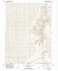
1991 Map of Crater Island
USGS Topo · Published 1992About this map
Donner-Reed Trail cuts across the southern portion of this landscape, marking the historic path taken by the ill-fated pioneer party. The route traverses the lower edge of the Crater Island Mountains at Donner-Reed Pass, providing a window into the difficult conditions of early westward migration. This terrain is defined by the stark transition between the elevated peaks of Silver Island and the surrounding expanse of Mud, an environment where water sources like Flowing Well and Drill Hole were essential for survival. Industrial activity is indicated by several Prospects and a Mine located on the northern slopes of the island. The map also identifies local geological features such as Caves, which dot the rocky outcrops and serve as points of interest for historical and geological research along the border of Box Elder Co and Toole Co.
Find a feature on this map
13 named features on this map. Tap any name to fly to it.
Don’t see what you’re looking for? This feature index may not catch every label — zoom into the map to look around manually.
Map Details
Editions of this 1991 Crater Island Map
This is the sole edition of this map. No revisions or reprints were ever made.
Other maps of this area

1953 · Tooele
USGS Topo · 1:250,000

1954 · Brigham City
USGS Topo · 1:250,000

1955 · Tooele
USGS Topo · 1:250,000

1958 · Brigham City
USGS Topo · 1:250,000

1962 · Brigham City
USGS Topo · 1:250,000
1967 · Crater Island SW
USGS Topo · 1:24,000

1967 · Lemay Island
USGS Topo · 1:24,000
1967 · Crater Island NW
USGS Topo · 1:24,000

1970 · Crater Island
USGS Topo · 1:24,000

1971 · Silver Island Pass
USGS Topo · 1:24,000