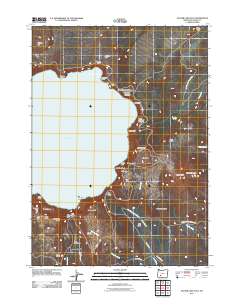
2011 Map of Crater Lake East
USGS Topo · Published 2011About this map
Crater Lake dominates this 2011 survey, revealing the eastern caldera rim and the high elevations of Crater Lake National Park. The topography is defined by dramatic volcanic features, from the submerged Phantom Ship to the massive Mount Scott, which hosts the Mount Scott Lookout at its peak. The shoreline is punctuated by notable formations such as Pumice Castle, Sentinel Rock, and Skell Head, illustrating the complex geological history of the Base of Mount Mazama. Extensive drainage systems including Sand Creek, Wheeler Creek, and Lost Creek carry water away from the rim toward the southeast. The arterial Rim Dr and Grayback Dr provide the primary access to famous overlooks like Victor View and Kerr Notch, where the land drops sharply from the Rugged Crest Palisades to the water's edge.
Find a feature on this map
53 named features on this map. Tap any name to fly to it.
Don’t see what you’re looking for? This feature index may not catch every label — zoom into the map to look around manually.
Map Details
Editions of this 2011 Crater Lake East Map
This is the sole edition of this map. No revisions or reprints were ever made.
Other maps of this area

1889 · Klamath
USGS Topo · 1:250,000

1891 · Ashland
USGS Topo · 1:250,000

1893 · Ashland
USGS Topo · 1:250,000

1894 · Klamath
USGS Topo · 1:250,000

1897 · Ashland
USGS Topo · 1:250,000

1917 · Diamond Lake
USGS Topo · 1:125,000

1935 · Chemult
USGS Topo · 1:96,000

1941 · Chemult
USGS Topo · 1:125,000

1955 · Crescent
USGS Topo · 1:250,000

1955 · Klamath Falls
USGS Topo · 1:250,000