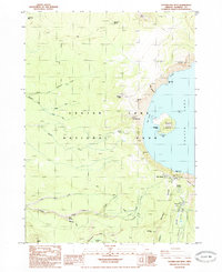
1985 Map of Crater Lake West
USGS Topo · Published 1985About this map
Wizard Island rises from the western waters of Crater Lake, anchoring this mid-1980s topographical study within Crater Lake National Park. The survey details the high rim infrastructure, including the Rim Village area with its historic Crater Lake Lodge and the Sinnott Memorial overlooking the caldera. Beyond the water, the landscape is defined by volcanic features like Williams Crater, Hillman Pk, and the sheer rise of Llao Rock. The Pacific Crest National Scenic Trail winds through the western slopes, passing through drainage basins for Copeland Creek and Castle Creek. To the south, the park's administrative hub at Park Headquarters sits near Munson Valley, revealing the organized layout of roads and facilities that supported tourism and conservation during this era.
Find a feature on this map
49 named features on this map. Tap any name to fly to it.
Don’t see what you’re looking for? This feature index may not catch every label — zoom into the map to look around manually.
Map Details
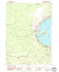
Editions of this 1985 Crater Lake West Map
2 editions found
Other maps of this area

1891 · Ashland
USGS Topo · 1:250,000

1893 · Ashland
USGS Topo · 1:250,000

1897 · Ashland
USGS Topo · 1:250,000

1917 · Diamond Lake
USGS Topo · 1:125,000

1955 · Medford
USGS Topo · 1:250,000

1956 · Diamond Lake
USGS Topo · 1:62,500

1956 · Garwood Butte
USGS Topo · 1:62,500

1956 · Prospect
USGS Topo · 1:62,500

1957 · Medford
USGS Topo · 1:250,000

1958 · Medford
USGS Topo · 1:250,000