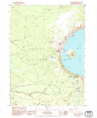
1985 Map of Crater Lake West
USGS Topo · Published 1995About this map
Crater Lake and its dramatic volcanic caldera dominate this mid-1980s topographical study. The map details the western rim's unique geologic formations, including the sheer face of Llao Rock and the volcanic cone of Wizard Island rising from the deep waters. This era shows the developed visitor corridor around Rim Village, where the Crater Lake Lodge and Sinnott Memorial overlook the caldera. Beyond the rim, the landscape transitions into the heavily dissected drainages of Bybee Creek and the various forks of Copeland Creek. Significant recreational infrastructure is recorded here, from the Pacific Crest National Scenic Trail winding through the western forests to the specialized Lookout House atop The Watchman. Downslope from the rim, the Park Headquarters and Munson Valley serve as the operational hub for the national park.
Find a feature on this map
43 named features on this map. Tap any name to fly to it.
Don’t see what you’re looking for? This feature index may not catch every label — zoom into the map to look around manually.
Map Details
Editions of this 1985 Crater Lake West Map
2 editions found
Other maps of this area

1891 · Ashland
USGS Topo · 1:250,000

1893 · Ashland
USGS Topo · 1:250,000

1897 · Ashland
USGS Topo · 1:250,000

1917 · Diamond Lake
USGS Topo · 1:125,000

1955 · Medford
USGS Topo · 1:250,000

1956 · Diamond Lake
USGS Topo · 1:62,500

1956 · Garwood Butte
USGS Topo · 1:62,500

1956 · Prospect
USGS Topo · 1:62,500

1957 · Medford
USGS Topo · 1:250,000

1958 · Medford
USGS Topo · 1:250,000