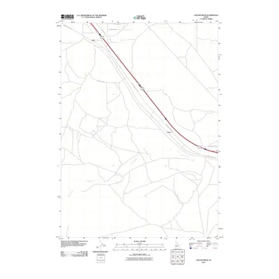
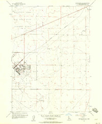
2010 Map of Crater Rings
USGS Topo · Published 2010About this map
Cleft and Sebree represent the primary points of human presence along the diagonal corridor of the Old Oregon Trail Hwy in Elmore County. This portion of the Idaho landscape is defined by its wide, open drainage patterns, most notably where Canyon Creek meanders through the southern sections of the survey. The transport network reflects a transition from historic movement along the Oregon Trail to modern accessibility via local routes like Simco Cutoff Rd and Faulkner Rd. While much of the terrain remains undeveloped, the grid of names such as Seabreeze Ave and Desert Duck Rd suggests early 21st-century rural partitioning and land use. The topography is subtle, with the infrastructure largely conforming to the natural path of the high desert plateau.
Find a feature on this map
10 named features on this map. Tap any name to fly to it.
Don’t see what you’re looking for? This feature index may not catch every label — zoom into the map to look around manually.
Map Details
Editions of this 2010 Crater Rings Map
This is the sole edition of this map. No revisions or reprints were ever made.
Other maps of this area

1892 · Mountain Home
USGS Topo · 1:125,000

1893 · Mountain Home
USGS Topo · 1:125,000

1955 · Hailey
USGS Topo · 1:250,000
1956 · Mountain Home South
USGS Topo · 1:24,000
1956 · Cinder Cone Butte
USGS Topo · 1:24,000

1956 · Crater Rings
USGS Topo · 1:24,000

1956 · Mountain Home North
USGS Topo · 1:24,000
1956 · Crater Rings SW
USGS Topo · 1:24,000

1956 · Mountain Home
USGS Topo · 1:62,500
1956 · Crater Rings SE
USGS Topo · 1:24,000