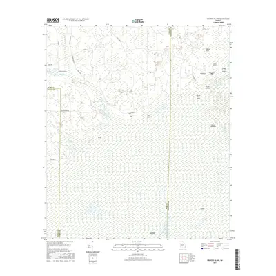
2017 Map of Cravens Island
USGS Topo · Published 2017About this map
The Okefenokee Swamp dominates this landscape on the border of Clinch, Ware, and Charlton Counties, revealing a complex network of wetland features and family-named landmarks. The settlement of Hopkins serves as a primary point of reference in the northern portion of the quadrangle, situated near the headwaters of Suwannee Creek. The map documents a geography of elevation islands and hammocks that emerge from the wetlands, including Cravens Island, Hickory Hammock, and Greasy Branch Island.
Find a feature on this map
41 named features on this map. Tap any name to fly to it.
Don’t see what you’re looking for? This feature index may not catch every label — zoom into the map to look around manually.
Map Details
Editions of this 2017 Cravens Island Map
This is the sole edition of this map. No revisions or reprints were ever made.
Other maps of this area

1953 · Waycross
USGS Topo · 1:250,000

1954 · Valdosta
USGS Topo · 1:250,000

1958 · Valdosta
USGS Topo · 1:250,000

1958 · Waycross
USGS Topo · 1:250,000

1959 · Valdosta
USGS Topo · 1:250,000

1965 · Dinner Pond
USGS Topo · 1:24,000
1966 · Billys Island
USGS Topo · 1:24,000

1966 · The Pocket
USGS Topo · 1:24,000

1966 · Cravens Island
USGS Topo · 1:24,000

1967 · Waycross SE
USGS Topo · 1:24,000