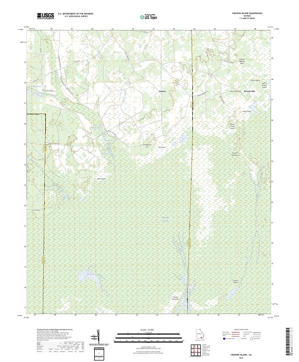
2024 Map of Cravens Island
USGS Topo · Published 2024About this map
Hopkins serves as a primary access point for the northern reaches of the Okefenokee National Wildlife Refuge, where the transition from managed timberlands to protected swamp is marked by Swamp Perimeter Rd. The landscape is defined by its subtle variations in elevation, where slightly higher ground creates named landmarks like Cravens Island and Burnt Island amidst the wet expanse of the Okefenokee Swamp. To the east, McLeods Mill sits near the winding corridor of Green Hammock, while the North Fork Suwannee River drains southward from Cravens Hammock. This modern survey illustrates the persistent boundary between the development in Ware County and the vast Okefenokee Wilderness, showing how roads like Hamp Mizell Rd and Old Hopkins Rd connect rural outposts to the swamp's edge.
Find a feature on this map
40 named features on this map. Tap any name to fly to it.
Don’t see what you’re looking for? This feature index may not catch every label — zoom into the map to look around manually.
Map Details
Editions of this 2024 Cravens Island Map
This is the sole edition of this map. No revisions or reprints were ever made.
Other maps of this area

1953 · Waycross
USGS Topo · 1:250,000

1954 · Valdosta
USGS Topo · 1:250,000

1958 · Valdosta
USGS Topo · 1:250,000

1958 · Waycross
USGS Topo · 1:250,000

1959 · Valdosta
USGS Topo · 1:250,000

1965 · Dinner Pond
USGS Topo · 1:24,000
1966 · Billys Island
USGS Topo · 1:24,000

1966 · The Pocket
USGS Topo · 1:24,000

1966 · Cravens Island
USGS Topo · 1:24,000

1967 · Waycross SE
USGS Topo · 1:24,000