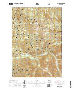
2020 Map of Crawfish Lake
USGS Topo · Published 2020About this map
Whitman National Forest dominates this high-altitude landscape where the headwaters of several major drainages begin. The eastern edge of the Elkhorn Mountains rises sharply here, bordering the North Fork John Day River which is designated as a Wild and Scenic River. In the southwestern corner, the site of Cabell City provides a point of historical interest for researchers of high-elevation mountain settlements. The map details a specialized transportation network of snowmobile routes, including the Chicken Hill Snowmobile and Elkhorn Drive Snowmobile trails, illustrating how modern recreational use is managed across peaks like Black Butte and Badger Butte. Notable alpine water features such as Crawfish Lake and Lookout Spring are positioned near the Union and Grant county boundary, marking essential landmarks in this drainage divide.
Find a feature on this map
41 named features on this map. Tap any name to fly to it.
Don’t see what you’re looking for? This feature index may not catch every label — zoom into the map to look around manually.
Map Details
Editions of this 2020 Crawfish Lake Map
This is the sole edition of this map. No revisions or reprints were ever made.
Other maps of this area

1901 · Sumpter
USGS Topo · 1:125,000

1953 · Pendleton
USGS Topo · 1:250,000

1955 · Canyon City
USGS Topo · 1:250,000

1956 · Pendleton
USGS Topo · 1:250,000

1959 · Canyon City
USGS Topo · 1:250,000

1965 · Limber Jim Creek
USGS Topo · 1:24,000

1965 · Anthony Butte
USGS Topo · 1:24,000

1965 · Fly Valley
USGS Topo · 1:24,000

1972 · Trout Meadows
USGS Topo · 1:24,000

1972 · Mt. Ireland
USGS Topo · 1:24,000