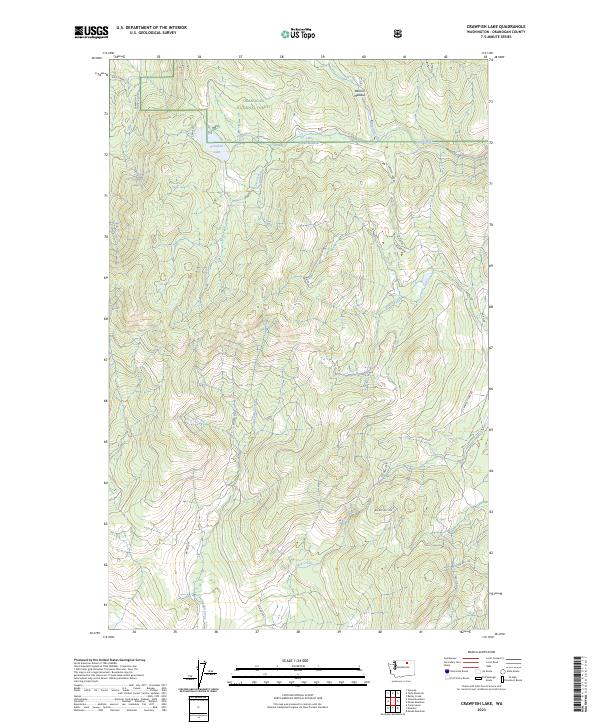
2023 Map of Crawfish Lake
USGS Topo · Published 2023About this map
Okanogan National Forest covers much of this high-elevation terrain in Washington, characterized by a complex network of seasonal drainages and forest access routes. The namesake Crawfish Lake sits in the northwest, serving as a primary hydrologic feature alongside Barnell Meadow to the east. The landscape is defined by its drainages, including the southern flow of Swampkin Creek and the eastern reaches of Haden Creek and Barnell Creek. This 2023 survey illustrates the modern configuration of administrative and tribal routes, such as BIA Rd 68 and BIA Rte No 1133, which provide access through the timbered sections of the forest. The map captures a contemporary look at land management within the Colville Reservation vicinity, showing the intersection of county roads like Co Hwy 3785 with the natural topography of Clark Creek and Lost Creek.
Find a feature on this map
25 named features on this map. Tap any name to fly to it.
Don’t see what you’re looking for? This feature index may not catch every label — zoom into the map to look around manually.
Map Details
Editions of this 2023 Crawfish Lake Map
This is the sole edition of this map. No revisions or reprints were ever made.
Other maps of this area

1902 · Osoyoos
USGS Topo · 1:125,000

1904 · Osoyoos
USGS Topo · 1:125,000

1952 · Disautel
USGS Topo · 1:62,500

1953 · Omak Lake
USGS Topo · 1:62,500

1954 · Okanogan
USGS Topo · 1:250,000

1957 · Tonasket
USGS Topo · 1:62,500

1957 · Aeneas Valley
USGS Topo · 1:62,500

1958 · Okanogan
USGS Topo · 1:250,000
1980 · Camp Seven
USGS Topo · 1:24,000
1980 · Omak Mountain
USGS Topo · 1:24,000