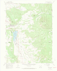
1965 Map of Crawford
USGS Topo · Published 1968About this map
Crawford serves as the focal point of this mid-1960s landscape, situated at the edge of the Fruitland Mesa where agricultural infrastructure meets the rising terrain of the Gunnison National Forest. The map documents a sophisticated water management system critical to high-country farming, featuring the Crawford Reservoir and its spillway, alongside complex irrigation works like the Aspen Ditch, Clipper Ditch, and the Grand Siphon. To the south, the small community of Maher is connected via roads that follow the drainage of Iron Creek.
Find a feature on this map
38 named features on this map. Tap any name to fly to it.
Don’t see what you’re looking for? This feature index may not catch every label — zoom into the map to look around manually.
Map Details
Editions of this 1965 Crawford Map
3 editions found
Other maps of this area

1938 · Mt. Gunnison
USGS Topo · 1:48,000

1945 · Mount Gunnison
USGS Topo · 1:62,500

1956 · Montrose
USGS Topo · 1:250,000

1957 · Cathedral Peak
USGS Topo · 1:24,000

1957 · X Lazy F Ranch
USGS Topo · 1:24,000

1957 · Grizzly Ridge
USGS Topo · 1:24,000

1959 · Montrose
USGS Topo · 1:250,000

1960 · Montrose
USGS Topo · 1:250,000

1964 · Minnesota Pass
USGS Topo · 1:24,000

1965 · Mount Guero
USGS Topo · 1:24,000