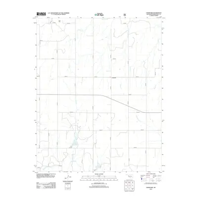
2012 Map of Crawford
USGS Topo · Published 2012About this map
The Washita River meanders across the southern edge of this West Oklahoma landscape, defining the hydrology of a region where high plains meet a network of seasonal drainages. Centered around the small community of Crawford, the terrain is marked by the distinctive Twin Hills to the northwest and a grid of rural section roads that navigate the varying elevations. This 2012 survey illustrates a landscape of intermittent streams, including Dugout Cr, Bull Cr, and Dead Warrior Cr, which carve shallow valleys into the prairie. Water management is evident at Spring Cr Lake along Spring Cr, while local heritage is anchored by the Sunrise Cem near the riverbanks. The map's detailed road network, from n1790 RD to e0820 RD, provides a clear view of the modern land divisions and rural homesteads that characterize Roger Mills County.
Find a feature on this map
32 named features on this map. Tap any name to fly to it.
Don’t see what you’re looking for? This feature index may not catch every label — zoom into the map to look around manually.
Map Details
Editions of this 2012 Crawford Map
This is the sole edition of this map. No revisions or reprints were ever made.
Other maps of this area

1955 · Clinton
USGS Topo · 1:250,000

1957 · Clinton
USGS Topo · 1:250,000

1960 · Cheyenne
USGS Topo · 1:62,500

1961 · Reydon
USGS Topo · 1:62,500

1965 · Roll NW
USGS Topo · 1:24,000

1965 · Crawford
USGS Topo · 1:24,000

1966 · Roll
USGS Topo · 1:24,000

1966 · Antelope Hills NE
USGS Topo · 1:24,000

1966 · Antelope Hills
USGS Topo · 1:24,000

1966 · Durham
USGS Topo · 1:24,000