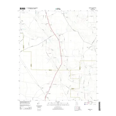
2014 Map of Crawley
USGS Topo · Published 2014About this map
Bolen and Crawley anchor this rural landscape where the borders of Ware, Bacon, and Pierce counties converge. The terrain is defined by a dendritic network of slow-moving water, most notably Little Hurricane Cr and Hurricane Cr, which drain through the flat woodlands of Southeast Georgia. Settlement patterns are largely dispersed along routes like Beach Hwy, with the presence of multiple family and community burial grounds such as Elisabeth Chapel Cem, Lees Chapel Cem, and Harrison Cem indicating deep-rooted local history. This 2014 survey documents a region still heavily engaged in timber or agriculture, evidenced by a dense grid of named rural lanes like Pine Cone Rd and Cotton Rd, which provide access to the interior wetlands and small water bodies like Whitley Lake.
Find a feature on this map
91 named features on this map. Tap any name to fly to it.
Don’t see what you’re looking for? This feature index may not catch every label — zoom into the map to look around manually.
Map Details
Editions of this 2014 Crawley Map
This is the sole edition of this map. No revisions or reprints were ever made.
Other maps of this area

1953 · Waycross
USGS Topo · 1:250,000

1958 · Waycross
USGS Topo · 1:250,000

1971 · Dixie Union
USGS Topo · 1:24,000

1971 · Coffee
USGS Topo · 1:24,000

1971 · Beach
USGS Topo · 1:24,000

1971 · Alma
USGS Topo · 1:24,000

1971 · Sessoms
USGS Topo · 1:24,000

1971 · Talmo
USGS Topo · 1:24,000

1971 · Blackshear West
USGS Topo · 1:24,000

1971 · Mershon
USGS Topo · 1:24,000