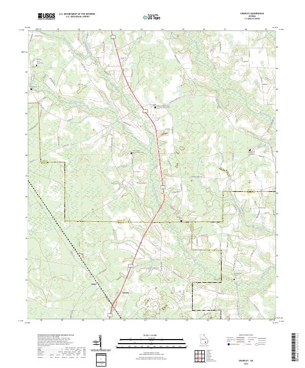
2024 Map of Crawley
USGS Topo · Published 2024About this map
Crawley and Bolen serve as central nodes in this rural Georgia landscape, where the borders of Bacon, Ware, and Pierce counties converge. The geography is defined by a dense network of waterways, including the winding course of Little Hurricane Creek and its various tributaries like Mill Branch and Rigdon Branch. This area is notable for its high concentration of local religious and burial sites, which suggest a long-standing community structure built around family and faith. Genealogists can trace several prominent local institutions, from Old Pine Grove Church Cem in the northwest to Beulah Baptist Church Cem in the southeast. The terrain is relatively low-lying, punctuated by small bodies of water like Whitley Lake and an extensive system of rural roads named for native flora, such as Peartree Rd and Satinwood Ln.
Find a feature on this map
89 named features on this map. Tap any name to fly to it.
Don’t see what you’re looking for? This feature index may not catch every label — zoom into the map to look around manually.
Map Details
Editions of this 2024 Crawley Map
This is the sole edition of this map. No revisions or reprints were ever made.
Other maps of this area

1953 · Waycross
USGS Topo · 1:250,000

1958 · Waycross
USGS Topo · 1:250,000

1971 · Dixie Union
USGS Topo · 1:24,000

1971 · Coffee
USGS Topo · 1:24,000

1971 · Beach
USGS Topo · 1:24,000

1971 · Alma
USGS Topo · 1:24,000

1971 · Sessoms
USGS Topo · 1:24,000

1971 · Talmo
USGS Topo · 1:24,000

1971 · Blackshear West
USGS Topo · 1:24,000

1971 · Mershon
USGS Topo · 1:24,000