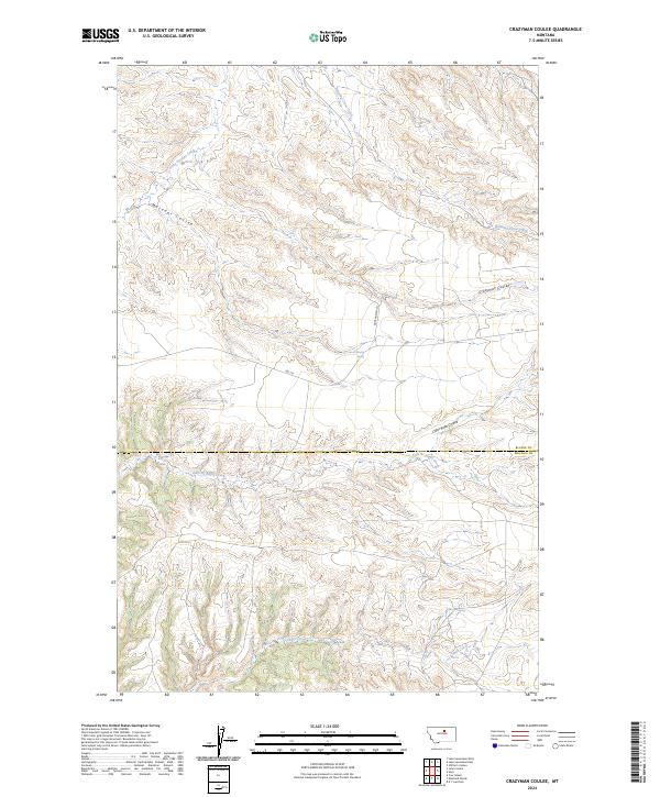
2024 Map of Crazyman Coulee
USGS Topo · Published 2024About this map
The Upper Missouri River Breaks National Monument anchors the southwest corner of this map, protecting a landscape where the river's erosion has carved deep drainages into the northern plains. This terrain is defined by a network of seasonal watercourses and springs, including the descriptively named Kills At Night Creek and Cabin Creek. The land is dissected by numerous coulees, such as Matador Coulee and Crazyman Coulee, which serve as natural landmarks in a region largely defined by its topography rather than dense settlement.
Find a feature on this map
17 named features on this map. Tap any name to fly to it.
Don’t see what you’re looking for? This feature index may not catch every label — zoom into the map to look around manually.
Map Details
Editions of this 2024 Crazyman Coulee Map
This is the sole edition of this map. No revisions or reprints were ever made.
Other maps of this area

1943 · Landusky
USGS Topo · 1:125,000

1953 · Havre
USGS Topo · 1:250,000

1954 · Cow Island
USGS Topo · 1:24,000

1954 · Lewistown
USGS Topo · 1:250,000

1957 · Havre
USGS Topo · 1:250,000

1958 · Havre
USGS Topo · 1:250,000

1959 · Lewistown
USGS Topo · 1:250,000

1971 · Crazyman Coulee
USGS Topo · 1:24,000

1971 · Hays
USGS Topo · 1:24,000
1971 · Stiffarm Coulee
USGS Topo · 1:24,000