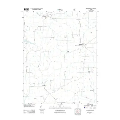
2012 Map of Creal Springs
USGS Topo · Published 2012About this map
Creal Springs and New Burnside anchor this landscape of the early 21st century, where southern Illinois transitions between the headwaters of the S Fork Saline River and the rolling uplands of Wise Ridge. The settlement pattern reflects a deeply rooted community, with numerous small crossroads like Tunnel Hill and Ozark connected by a network of named country lanes. For genealogists, the map is particularly dense with rural burial grounds, including the Salem Cem, Rich Cem, and Woodside Cem, which are scattered throughout the hills.
Find a feature on this map
72 named features on this map. Tap any name to fly to it.
Don’t see what you’re looking for? This feature index may not catch every label — zoom into the map to look around manually.
Map Details
Editions of this 2012 Creal Springs Map
This is the sole edition of this map. No revisions or reprints were ever made.
Other maps of this area

1917 · Brownfield
USGS Topo · 1:62,500

1918 · Vienna
USGS Topo · 1:62,500

1919 · Vienna
USGS Topo · 1:62,500

1925 · Marion
USGS Topo · 1:62,500

1925 · Harrisburg
USGS Topo · 1:62,500

1939 · Harrisburg
USGS Topo · 1:62,500

1940 · Marion
USGS Topo · 1:62,500

1942 · Vienna
USGS Topo · 1:62,500

1949 · Paducah
USGS Topo · 1:250,000

1950 · Paducah
USGS Topo · 1:250,000