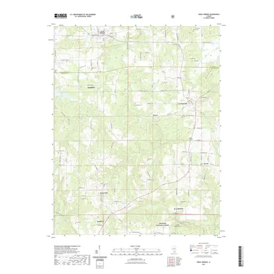
2021 Map of Creal Springs
USGS Topo · Published 2021About this map
Creal Springs serves as a northern anchor for this landscape, which spans the border of Williamson and Johnson counties. The terrain transitions into the protected woodlands of the Shawnee National Forest, where unique geological formations like the Cedar Wonders Arch and the waters of Lake of Egypt define the local geography. The settlement pattern is characterized by small communities such as New Burnside, Tunnel Hill, and Ozark, connected by a network of winding roads and the drainage of Sugar Cr and Little Cache Cr. Local history is deeply embedded in the land through numerous small family and community burial grounds, including the Wise Robinson Cem, Woodside Cem, and Reynoldsburg Cem. These sites, along with rural landmarks like Gilead Church, provide a detailed record of the families that established these southern Illinois townships.
Find a feature on this map
110 named features on this map. Tap any name to fly to it.
Don’t see what you’re looking for? This feature index may not catch every label — zoom into the map to look around manually.
Map Details
Editions of this 2021 Creal Springs Map
This is the sole edition of this map. No revisions or reprints were ever made.
Other maps of this area

1917 · Brownfield
USGS Topo · 1:62,500

1918 · Vienna
USGS Topo · 1:62,500

1919 · Vienna
USGS Topo · 1:62,500

1925 · Marion
USGS Topo · 1:62,500

1925 · Harrisburg
USGS Topo · 1:62,500

1939 · Harrisburg
USGS Topo · 1:62,500

1940 · Marion
USGS Topo · 1:62,500

1942 · Vienna
USGS Topo · 1:62,500

1949 · Paducah
USGS Topo · 1:250,000

1950 · Paducah
USGS Topo · 1:250,000