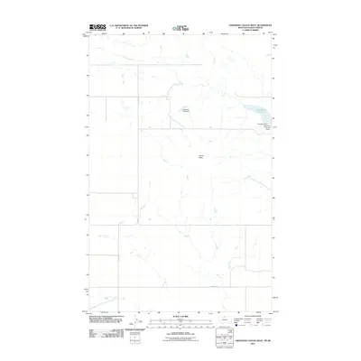
2011 Map of Creedman Coulee West
USGS Topo · Published 2011About this map
Creedman Reservoir and its associated water management structures dominate the high plains landscape of Hill County near the Canadian border. This 2011 survey illustrates a sparse, working landscape defined by water storage and intermittent drainages, where engineering is essential to the local environment. Multiple barriers, including Creedman Dam, Creedman Number 2 Dam, and the distinctively named Sassy Top Deck Dam, manage the flow through this semi-arid region. Local topography is punctuated by Signal Butte, a significant landmark for navigation and orientation across the open terrain. Transport is limited to a grid of rural routes such as Simpson Rd and Amos Trl, which connect the scattered agricultural and ranching operations characteristic of the Montana-Saskatchewan frontier.
Find a feature on this map
7 named features on this map. Tap any name to fly to it.
Don’t see what you’re looking for? This feature index may not catch every label — zoom into the map to look around manually.
Map Details
Editions of this 2011 Creedman Coulee West Map
This is the sole edition of this map. No revisions or reprints were ever made.
Other maps of this area

1912 · Thibedeau Lake
USGS Topo · 1:125,000

1953 · Havre
USGS Topo · 1:250,000

1957 · Havre
USGS Topo · 1:250,000

1958 · Havre
USGS Topo · 1:250,000

1972 · Hilldale Colony
USGS Topo · 1:24,000
1972 · Lake Thibadeau SW
USGS Topo · 1:24,000
1972 · Cottonwood
USGS Topo · 1:24,000
1972 · Creedman Coulee East
USGS Topo · 1:24,000
1972 · Wild Horse Lake East
USGS Topo · 1:24,000
1972 · Creedman Coulee West
USGS Topo · 1:24,000