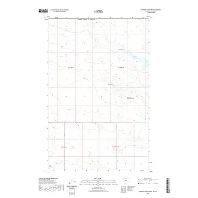
2020 Map of Creedman Coulee West
USGS Topo · Published 2020About this map
Signal Butte rises above the drainage networks of Hill County in this northern Montana landscape near the Canadian border. The terrain is defined by a series of erosional channels including Creedman Coulee and the South Fork Greenman Coulee, which illustrate the complex hydrology of this high plains region. Small water impoundments like Creedman Reservoir reflect the necessity of water management in this environment. While the landscape is largely characterized by open space and section lines of the Public Land Survey System, local routes such as Amos Trl provide the few human markers in an area shaped by the seasonal flow of drainages like Dog Coulee. This map serves as a precise record of the remote intersections of Township 37 North and the international boundary.
Find a feature on this map
11 named features on this map. Tap any name to fly to it.
Don’t see what you’re looking for? This feature index may not catch every label — zoom into the map to look around manually.
Map Details
Editions of this 2020 Creedman Coulee West Map
This is the sole edition of this map. No revisions or reprints were ever made.
Other maps of this area

1912 · Thibedeau Lake
USGS Topo · 1:125,000

1953 · Havre
USGS Topo · 1:250,000

1957 · Havre
USGS Topo · 1:250,000

1958 · Havre
USGS Topo · 1:250,000

1972 · Hilldale Colony
USGS Topo · 1:24,000
1972 · Lake Thibadeau SW
USGS Topo · 1:24,000
1972 · Cottonwood
USGS Topo · 1:24,000
1972 · Creedman Coulee East
USGS Topo · 1:24,000
1972 · Wild Horse Lake East
USGS Topo · 1:24,000
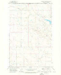
1972 · Creedman Coulee West
USGS Topo · 1:24,000