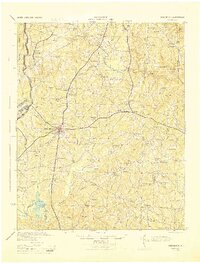
1944 Map of Creedmoor
USGS Topo · Published 1944About this map
Camp Butner Military Reservation dominates the western edge of this 1944 survey, reflecting the rapid mobilization of the Second World War as it overtook rural Granville County. Outside the military boundaries, the landscape is defined by the intersection of the Seaboard Railway and Southern Railway at Creedmoor, a vital shipping point for the region's agricultural output. This era shows a dense network of small tobacco-growing communities and rural social centers, including Tallyho, Fairport, and Pokomoke.
Find a feature on this map
96 named features on this map. Tap any name to fly to it.
Don’t see what you’re looking for? This feature index may not catch every label — zoom into the map to look around manually.
Map Details
Editions of this 1944 Creedmoor Map
This is the sole edition of this map. No revisions or reprints were ever made.
Other maps of this area

1943 · Durham South
USGS Topo · 1:62,500
1943 · Raleigh
USGS Topo · 1:62,500
1943 · Roxboro
USGS Topo · 1:62,500
1943 · Creedmoor
USGS Topo · 1:62,500
1951 · Raleigh
USGS Topo · 1:62,500

1951 · Durham South
USGS Topo · 1:62,500

1951 · Durham North
USGS Topo · 1:62,500
1953 · Oxford
USGS Topo · 1:62,500

1953 · Raleigh
USGS Topo · 1:250,000

1953 · Greensboro
USGS Topo · 1:250,000