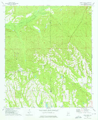
1973 Map of Creek Stand
USGS Topo · Published 1975About this map
Creek Stand and the surrounding rural landscapes of Macon County are defined by a complex network of waterways and small community centers. The northern reaches of the quadrangle are dominated by the Opintlocco Swamp, where Kelly Creek and Peters Branch feed into the wetland system. The settlement of Boromville serves as a central landmark, situated near the Borom Cem and several unnamed sandpits, illustrating the local importance of both family lineage and small-scale resource extraction.
Find a feature on this map
18 named features on this map. Tap any name to fly to it.
Don’t see what you’re looking for? This feature index may not catch every label — zoom into the map to look around manually.
Map Details
Editions of this 1973 Creek Stand Map
2 editions found
Other maps of this area

1955 · Phenix City
USGS Topo · 1:250,000

1957 · Phenix City
USGS Topo · 1:250,000

1958 · Phenix City
USGS Topo · 1:250,000

1971 · Little Texas
USGS Topo · 1:24,000
1971 · Marvyn
USGS Topo · 1:24,000
1971 · Society Hill
USGS Topo · 1:24,000
1973 · Hatchechubbee
USGS Topo · 1:24,000
1973 · Hurtsboro
USGS Topo · 1:24,000
1973 · Rutherford
USGS Topo · 1:24,000
1973 · Roba
USGS Topo · 1:24,000