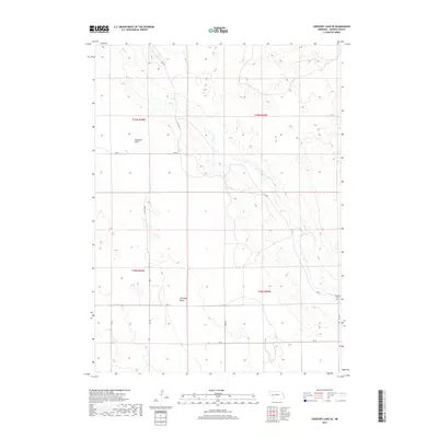
2017 Map of Crescent Lake SE
USGS Topo · Published 2017About this map
Blue Cr meanders through the heart of this Garden County landscape, cutting a path between Dogtown Flats to the north and the wide expanse of Antelope Valley to the south. This area is defined by its sparse, rural character where the section lines of the Public Land Survey System dictate the movement of local traffic along routes like Rd 82 and Rd 181. The most significant point of interest for genealogists and local historians is the Kingery Cem, located in the southeastern portion of the map near the intersection of several local connectors. The presence of State Hwy 27 provides the primary north-south artery through this stretch of Nebraska ranch land, connecting the isolated homesteads and grazing areas that characterize the region's economy.
Find a feature on this map
18 named features on this map. Tap any name to fly to it.
Don’t see what you’re looking for? This feature index may not catch every label — zoom into the map to look around manually.
Map Details
Editions of this 2017 Crescent Lake SE Map
This is the sole edition of this map. No revisions or reprints were ever made.
Other maps of this area

1900 · Chappell
USGS Topo · 1:125,000

1949 · Rackett
USGS Topo · 1:62,500

1950 · Crescent Lake
USGS Topo · 1:62,500

1951 · Rackett
USGS Topo · 1:62,500

1954 · Scottsbluff
USGS Topo · 1:250,000

1958 · Scottsbluff
USGS Topo · 1:250,000
1971 · Twin Buttes
USGS Topo · 1:24,000

1971 · Coumbe Bluff
USGS Topo · 1:24,000
1971 · Oshkosh
USGS Topo · 1:24,000
1985 · Chappell
USGS Topo · 1:100,000