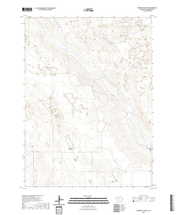
2021 Map of Crescent Lake SE
USGS Topo · Published 2021About this map
Blue Cr winds through the sandhills of Garden County, carving a distinct path through the open terrain of Dogtown Flats and the broad Antelope Valley. This 2021 survey illustrates the rural infrastructure of the Nebraska Panhandle, where a network of section-line roads such as RD 82 and RD 74 connect isolated points across the landscape. The lone marked site of concentrated historical significance is Kingery Cem, situated near the junction of RD 82 and the county line. The map highlights the vast, low-density settlement patterns of this region, where modern transit routes like State Hwy 27 trace paths through land long defined by natural drainage and cattle range.
Find a feature on this map
17 named features on this map. Tap any name to fly to it.
Don’t see what you’re looking for? This feature index may not catch every label — zoom into the map to look around manually.
Map Details
Editions of this 2021 Crescent Lake SE Map
This is the sole edition of this map. No revisions or reprints were ever made.
Other maps of this area

1900 · Chappell
USGS Topo · 1:125,000

1949 · Rackett
USGS Topo · 1:62,500

1950 · Crescent Lake
USGS Topo · 1:62,500

1951 · Rackett
USGS Topo · 1:62,500

1954 · Scottsbluff
USGS Topo · 1:250,000

1958 · Scottsbluff
USGS Topo · 1:250,000
1971 · Twin Buttes
USGS Topo · 1:24,000

1971 · Coumbe Bluff
USGS Topo · 1:24,000
1971 · Oshkosh
USGS Topo · 1:24,000
1985 · Chappell
USGS Topo · 1:100,000