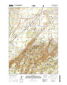
2014 Map of Crescent NE
USGS Topo · Published 2014About this map
Walker Rim dominates the southern landscape of this Oregon territory, marking a significant geological boundary within the high plateau region. This 2014 survey documents the convergence of two major federal land tracts, where the Deschutes National Forest meets the Winema National Forest. The map detail focuses on the intricate network of forest service infrastructure, specifically the numerous development roads that navigate the varying elevations. Unlike more settled regions, the area is defined by its lack of permanent structures or towns, highlighting its role as a managed timber and recreation resource. Local history and outdoor enthusiasts can trace the paths of Nat For Dev Rd 9760 and Nat For Dev Rd 9775 as they wind through the dense forest sections and over the prominent ridge lines.
Find a feature on this map
18 named features on this map. Tap any name to fly to it.
Don’t see what you’re looking for? This feature index may not catch every label — zoom into the map to look around manually.
Map Details
Editions of this 2014 Crescent NE Map
This is the sole edition of this map. No revisions or reprints were ever made.
Other maps of this area

1930 · Maiden Peak
USGS Topo · 1:125,000

1931 · Newberry Crater
USGS Topo · 1:125,000

1934 · Maiden Peak
USGS Topo · 1:125,000

1935 · Chemult
USGS Topo · 1:96,000

1935 · Newberry Crater
USGS Topo · 1:125,000

1941 · Chemult
USGS Topo · 1:125,000

1955 · Crescent
USGS Topo · 1:250,000

1957 · Crescent
USGS Topo · 1:250,000

1958 · Crescent
USGS Topo · 1:250,000

1963 · Masten Butte
USGS Topo · 1:24,000