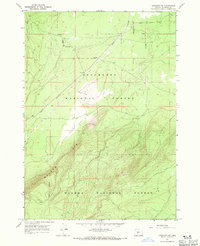
1967 Map of Crescent NE
USGS Topo · Published 1971About this map
The dramatic escarpment of Walker Rim dominates this landscape, marking a stark topographical boundary in central Oregon. This 1967 field-checked survey highlights the convergence of two major timberlands, the Deschutes National Forest and Winema National Forest. Running diagonally through the lower elevations north of the rim is the Great Northern railroad line, a critical corridor for transport in this high-desert forest region. Along these tracks, the specialized Freemont Siding serves as a lone industrial marker in a territory otherwise defined by complex contour lines and forest service boundaries. The map provides a precise view of the terrain just as modern photogrammetric methods were being refined by the Geological Survey, documenting the intersection of geology and rail infrastructure.
Find a feature on this map
6 named features on this map. Tap any name to fly to it.
Don’t see what you’re looking for? This feature index may not catch every label — zoom into the map to look around manually.
Map Details
Editions of this 1967 Crescent NE Map
This is the sole edition of this map. No revisions or reprints were ever made.
Other maps of this area

1930 · Maiden Peak
USGS Topo · 1:125,000

1931 · Newberry Crater
USGS Topo · 1:125,000

1934 · Maiden Peak
USGS Topo · 1:125,000

1935 · Chemult
USGS Topo · 1:96,000

1935 · Newberry Crater
USGS Topo · 1:125,000

1941 · Chemult
USGS Topo · 1:125,000

1955 · Crescent
USGS Topo · 1:250,000

1957 · Crescent
USGS Topo · 1:250,000

1958 · Crescent
USGS Topo · 1:250,000

1963 · Masten Butte
USGS Topo · 1:24,000