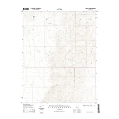
2014 Map of Crescent Spring
USGS Topo · Published 2014About this map
Logan Spring and the surrounding high-desert terrain of the Timpahute Range define this portion of Lincoln County. The landscape is characterized by a critical network of water sources, including Crescent Spring, Rye Grass Spring, and Tule Spring, which historically supported movement through this arid environment. The presence of Logan Cr within Logan Canyon highlights the significant natural drainages that shaped local travel and land use. Primitive routes such as Irish Mountain Rd and N Crescent Rd provide the primary access to these remote springs. These features reflect the enduring importance of water points in the Great Basin, serving as vital landmarks for early surveyors, ranchers, and travelers navigating the basin and range geography.
Find a feature on this map
16 named features on this map. Tap any name to fly to it.
Don’t see what you’re looking for? This feature index may not catch every label — zoom into the map to look around manually.
Map Details
Editions of this 2014 Crescent Spring Map
This is the sole edition of this map. No revisions or reprints were ever made.
Other maps of this area

1942 · Emigrant Valley
USGS Topo · 1:125,000

1942 · Penoyer Valley
USGS Topo · 1:125,000

1945 · Alamo
USGS Topo · 1:125,000

1954 · Caliente
USGS Topo · 1:250,000

1959 · Caliente
USGS Topo · 1:250,000

1964 · Tempiute Mtn
USGS Topo · 1:62,500
1983 · Crescent Reservoir
USGS Topo · 1:24,000
1983 · Hancock Summit
USGS Topo · 1:24,000
1983 · Groom Range NE
USGS Topo · 1:24,000

1985 · Pahranagat Range
USGS Topo · 1:100,000