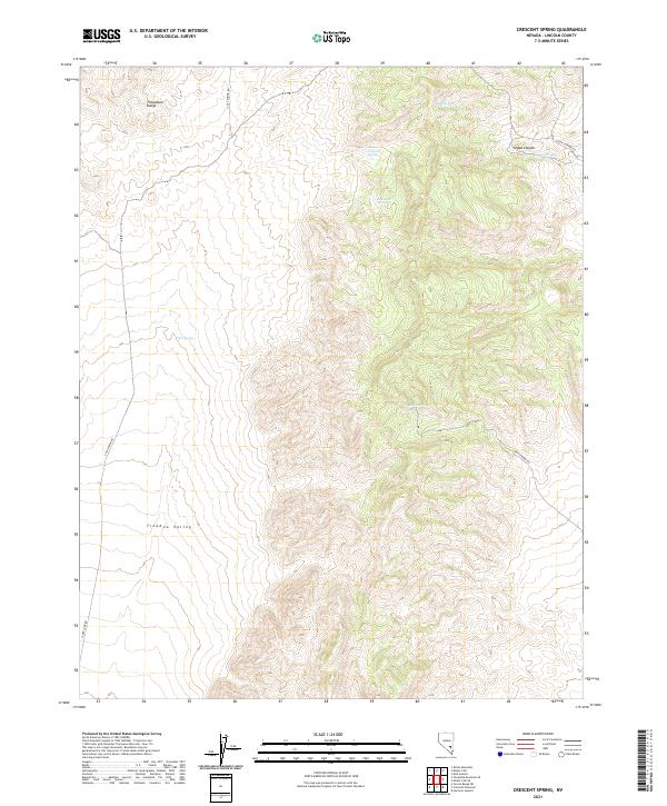
2021 Map of Crescent Spring
USGS Topo · Published 2021About this map
The Timpahute Range dominates the northwestern landscape of this Lincoln County region, where the high desert terrain descends into the broad expanse of the Tikaboo Valley. Life in this arid environment centers on rare water sources, with several vital points such as Crescent Spring, Tule Spring, and Logan Spring scattered across the basin and range. The presence of Logan Cr within the deep cut of Logan Canyon suggests a seasonal drainage system that has historically dictated movement through the area.
Find a feature on this map
18 named features on this map. Tap any name to fly to it.
Don’t see what you’re looking for? This feature index may not catch every label — zoom into the map to look around manually.
Map Details
Editions of this 2021 Crescent Spring Map
This is the sole edition of this map. No revisions or reprints were ever made.
Other maps of this area

1942 · Emigrant Valley
USGS Topo · 1:125,000

1942 · Penoyer Valley
USGS Topo · 1:125,000

1945 · Alamo
USGS Topo · 1:125,000

1954 · Caliente
USGS Topo · 1:250,000

1959 · Caliente
USGS Topo · 1:250,000

1964 · Tempiute Mtn
USGS Topo · 1:62,500
1983 · Crescent Reservoir
USGS Topo · 1:24,000
1983 · Hancock Summit
USGS Topo · 1:24,000
1983 · Groom Range NE
USGS Topo · 1:24,000

1985 · Pahranagat Range
USGS Topo · 1:100,000