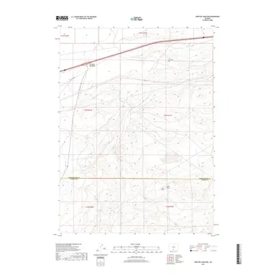
2017 Map of Creston Junction
USGS Topo · Published 2017About this map
Creston Junction marks a key intersection on the high plains of southern Wyoming where major transport routes cross the desert landscape. The map delineates the boundary between Sweetwater Co and Carbon Co, illustrating a terrain defined by subtle but distinct rises and seasonal watercourses. Prominent landmarks such as Cherokee Hill rise above the surrounding flats, while the drainages of Fillmore Cr provide the primary geographic relief across the various townships shown. This 2017 survey details the path of Creston Rd, providing a modern look at the roads and survey lines that structure this corner of the state. Further south, the high ground is dominated by Horse Butte and Cow Butte, which serve as natural navigation points in an area largely characterized by its vast open spaces and administrative boundaries.
Find a feature on this map
13 named features on this map. Tap any name to fly to it.
Don’t see what you’re looking for? This feature index may not catch every label — zoom into the map to look around manually.
Map Details
Editions of this 2017 Creston Junction Map
This is the sole edition of this map. No revisions or reprints were ever made.
Other maps of this area

1954 · Rawlins
USGS Topo · 1:250,000

1958 · Rawlins
USGS Topo · 1:250,000

1962 · Rawlins
USGS Topo · 1:250,000

1966 · Jawbone Ranch
USGS Topo · 1:24,000

1966 · Creston Junction
USGS Topo · 1:24,000

1966 · Seaverson Reservoir
USGS Topo · 1:24,000

1966 · Riner
USGS Topo · 1:24,000

1966 · Creston
USGS Topo · 1:24,000

1966 · High Point
USGS Topo · 1:24,000

1966 · Fillmore Ranch
USGS Topo · 1:24,000