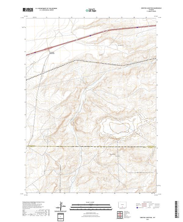
2021 Map of Creston Junction
USGS Topo · Published 2021About this map
Creston Junction serves as the primary landmark in this high-desert landscape, situated where Creston Rd meets the interstate corridor. The terrain is defined by isolated topographic rises, most notably Cherokee Hill in the north and the adjacent peaks of Horse Butte and Cow Butte further south. These landmarks rise above the drainage of Fillmore Cr, which threads through the center of the quadrangle. The map captures the meeting point of Sweetwater and Carbon counties, illustrating the straight-line boundary that bisects this wide-open region. The drainage patterns of the seasonal creek and the orientation of the primitive roads provide insight into the transit routes through this part of the Wyoming interior.
Find a feature on this map
13 named features on this map. Tap any name to fly to it.
Don’t see what you’re looking for? This feature index may not catch every label — zoom into the map to look around manually.
Map Details
Editions of this 2021 Creston Junction Map
This is the sole edition of this map. No revisions or reprints were ever made.
Other maps of this area

1954 · Rawlins
USGS Topo · 1:250,000

1958 · Rawlins
USGS Topo · 1:250,000

1962 · Rawlins
USGS Topo · 1:250,000

1966 · Jawbone Ranch
USGS Topo · 1:24,000

1966 · Creston Junction
USGS Topo · 1:24,000

1966 · Seaverson Reservoir
USGS Topo · 1:24,000

1966 · Riner
USGS Topo · 1:24,000

1966 · Creston
USGS Topo · 1:24,000

1966 · High Point
USGS Topo · 1:24,000

1966 · Fillmore Ranch
USGS Topo · 1:24,000