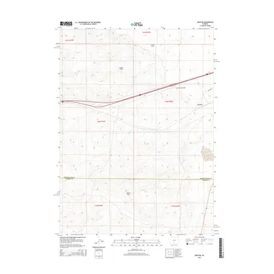
2015 Map of Creston
USGS Topo · Published 2015About this map
The Continental Divide defines the topography of this high-desert region, where drainage patterns are split between western and eastern basins. Located on the border of Sweetwater Co and Carbon Co, the small settlement of Creston is situated alongside the primary east-west transportation corridor, including the path of Creston Rd. The landscape is characterized by its arid drainage network, notably Creston Draw, Latham Draw, and Hansen Draw, which carve through the high-altitude terrain. This survey reflects the modern infrastructure of the Great Divide Basin, a region critical for energy and transportation where the legal boundaries of several townships, such as t20n r92w, meet. The layout demonstrates how early ranching and transport routes were dictated by the subtle dips and ridges of the divide, maintaining a pattern of settlement and utility that persists in the 21st century.
Find a feature on this map
13 named features on this map. Tap any name to fly to it.
Don’t see what you’re looking for? This feature index may not catch every label — zoom into the map to look around manually.
Map Details
Editions of this 2015 Creston Map
This is the sole edition of this map. No revisions or reprints were ever made.
Other maps of this area

1954 · Rawlins
USGS Topo · 1:250,000

1958 · Rawlins
USGS Topo · 1:250,000

1962 · Rawlins
USGS Topo · 1:250,000

1966 · Jawbone Ranch
USGS Topo · 1:24,000

1966 · Creston Junction
USGS Topo · 1:24,000

1966 · Wamsutter
USGS Topo · 1:24,000

1966 · Seaverson Reservoir
USGS Topo · 1:24,000

1966 · Monument Lake
USGS Topo · 1:24,000

1966 · Creston
USGS Topo · 1:24,000

1966 · High Point
USGS Topo · 1:24,000