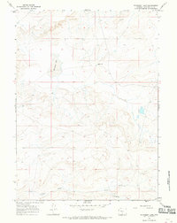
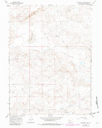
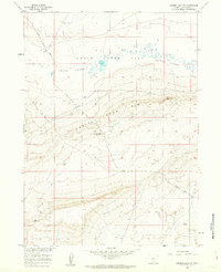
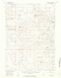
1966 Map of Monument Lake
USGS Topo · Published 1969About this map
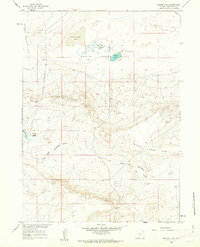
Monument Lake sits at the center of this 1960s topographic study of Sweetwater County, Wyoming. The landscape is defined by the high-desert terrain of the Great Divide Basin, where early water management is evidenced by the Fivemile Ditch running through the southern sections. This survey provides a record of human presence in a sparse region, documenting remote ranching outposts such as Larsens Ranch and the Hadsell Place. Evidence of subsurface exploration is scattered throughout the area, marked by a Drill Hole in the northeast and several Well locations. These features suggest the early stages of resource assessment and the persistent effort to secure water in this arid Wyoming territory.
Find a feature on this map
6 named features on this map. Tap any name to fly to it.
Don’t see what you’re looking for? This feature index may not catch every label — zoom into the map to look around manually.
Map Details
Editions of this 1966 Monument Lake Map
2 editions found
Other maps of this area

1954 · Rawlins
USGS Topo · 1:250,000

1954 · Rock Springs
USGS Topo · 1:250,000

1958 · Rawlins
USGS Topo · 1:250,000

1958 · Rock Springs
USGS Topo · 1:250,000
1960 · Hansen Lake NE
USGS Topo · 1:24,000
1960 · Lost Creek Butte
USGS Topo · 1:62,500
1960 · Hansen Lake
USGS Topo · 1:24,000

1962 · Rawlins
USGS Topo · 1:250,000

1962 · Rock Springs
USGS Topo · 1:250,000
1966 · Wamsutter
USGS Topo · 1:24,000