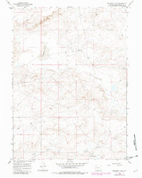
1966 Map of Monument Lake
USGS Topo · Published 1981About this map
Monument Lake sits at the center of this Sweetwater County landscape, surrounded by the high-desert basins of south-central Wyoming. The map depicts a territory largely defined by water management and mineral exploration, featuring the Fivemile Ditch cutting across the southern terrain. Human activity is sparse but specific, with isolated homesteads like Larsens Ranch and the Hadsell Place providing rare points of habitation in an otherwise open range. Industrial development is marked by several Well sites and a Drill Hole, alongside a long Pipeline that traverses the northern and southern sections. These features reflect the mid-century infrastructure required to support ranching and resource extraction in an arid environment where water and energy were the primary drivers of settlement.
Find a feature on this map
9 named features on this map. Tap any name to fly to it.
Don’t see what you’re looking for? This feature index may not catch every label — zoom into the map to look around manually.
Map Details
Editions of this 1966 Monument Lake Map
2 editions found

Other maps of this area

1954 · Rawlins
USGS Topo · 1:250,000

1954 · Rock Springs
USGS Topo · 1:250,000

1958 · Rawlins
USGS Topo · 1:250,000

1958 · Rock Springs
USGS Topo · 1:250,000

1960 · Hansen Lake NE
USGS Topo · 1:24,000

1960 · Lost Creek Butte
USGS Topo · 1:62,500

1960 · Hansen Lake
USGS Topo · 1:24,000

1962 · Rawlins
USGS Topo · 1:250,000

1962 · Rock Springs
USGS Topo · 1:250,000

1966 · Wamsutter
USGS Topo · 1:24,000