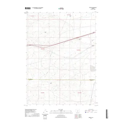
2017 Map of Creston
USGS Topo · Published 2017About this map
The Continental Divide crests through this high desert landscape, a defining topographic feature that dictates the drainage of seasonal waterways such as Creston Draw, Latham Draw, and Hansen Draw. The settlement of Creston is situated near the eastern edge of the quadrangle, serving as a landmark along the transit corridor that follows the gentle gradients of the divide. The map illustrates a sparse but critical infrastructure network in this arid portion of the Red Desert, where Creston Rd and Latham Ave provide access through the open range. The boundary between Sweetwater and Carbon counties bisects the southern half of the sheet, marking a political division in an otherwise continuous expanse of sagebrush and high-altitude plains. This 2017 survey details the intersection of historic transit routes with the natural geography of the American West.
Find a feature on this map
14 named features on this map. Tap any name to fly to it.
Don’t see what you’re looking for? This feature index may not catch every label — zoom into the map to look around manually.
Map Details
Editions of this 2017 Creston Map
This is the sole edition of this map. No revisions or reprints were ever made.
Other maps of this area

1954 · Rawlins
USGS Topo · 1:250,000

1958 · Rawlins
USGS Topo · 1:250,000

1962 · Rawlins
USGS Topo · 1:250,000

1966 · Jawbone Ranch
USGS Topo · 1:24,000

1966 · Creston Junction
USGS Topo · 1:24,000

1966 · Wamsutter
USGS Topo · 1:24,000

1966 · Seaverson Reservoir
USGS Topo · 1:24,000

1966 · Monument Lake
USGS Topo · 1:24,000

1966 · Creston
USGS Topo · 1:24,000

1966 · High Point
USGS Topo · 1:24,000