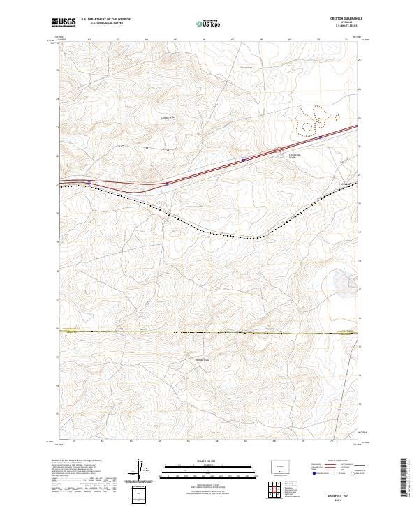
2021 Map of Creston
USGS Topo · Published 2021About this map
The Continental Divide traverses this high-desert landscape in south-central Wyoming, marking a significant hydrologic boundary that bisects the terrain. Near the eastern edge of the map, the small settlement of Creston is situated along the main transportation corridor of Interstate 80 and the nearby Creston Rd. This area is characterized by vast drainage systems like Creston Draw, Latham Draw, and Hansen Draw which cut through the high plains toward the Sweetwater and Carbon County line. The map highlights the sparse, infrastructure-dependent development typical of the Red Desert region, where modern transit routes follow the natural path of least resistance across the divide.
Find a feature on this map
13 named features on this map. Tap any name to fly to it.
Don’t see what you’re looking for? This feature index may not catch every label — zoom into the map to look around manually.
Map Details
Editions of this 2021 Creston Map
This is the sole edition of this map. No revisions or reprints were ever made.
Other maps of this area

1954 · Rawlins
USGS Topo · 1:250,000

1958 · Rawlins
USGS Topo · 1:250,000

1962 · Rawlins
USGS Topo · 1:250,000

1966 · Jawbone Ranch
USGS Topo · 1:24,000

1966 · Creston Junction
USGS Topo · 1:24,000

1966 · Wamsutter
USGS Topo · 1:24,000

1966 · Seaverson Reservoir
USGS Topo · 1:24,000

1966 · Monument Lake
USGS Topo · 1:24,000

1966 · Creston
USGS Topo · 1:24,000

1966 · High Point
USGS Topo · 1:24,000