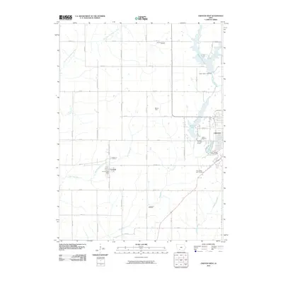
2010 Map of Creston West
USGS Topo · Published 2010About this map
Cromwell and the western edge of Creston anchor this 2010 topographic record of Union County's agricultural and recreational landscape. The town of Cromwell is detailed down to its Cromwell Post Office, while the surrounding prairie is defined by a series of north-south drainage basins, including the West Platte River and the East Fork East Nodaway River. This modern survey illustrates the importance of water management and recreation in the region, featuring several prominent reservoirs such as Green Valley Lake, Summit Lake, and Lake McKinley.
Find a feature on this map
48 named features on this map. Tap any name to fly to it.
Don’t see what you’re looking for? This feature index may not catch every label — zoom into the map to look around manually.
Map Details
Editions of this 2010 Creston West Map
This is the sole edition of this map. No revisions or reprints were ever made.
Other maps of this area

1954 · Omaha
USGS Topo · 1:250,000

1955 · Nebraska City
USGS Topo · 1:250,000

1957 · Nebraska City
USGS Topo · 1:250,000

1957 · Omaha
USGS Topo · 1:250,000

1958 · Omaha
USGS Topo · 1:250,000

1958 · Nebraska City
USGS Topo · 1:250,000

1980 · Lenox
USGS Topo · 1:24,000

1980 · Nevinville
USGS Topo · 1:24,000

1980 · Creston East
USGS Topo · 1:24,000
1980 · Prescott
USGS Topo · 1:24,000