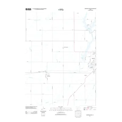
2013 Map of Creston West
USGS Topo · Published 2013About this map
Creston anchors the eastern edge of this landscape, where the residential grid meets the recreational waters of Summit Lake. Moving west, the terrain is defined by the headwaters of the Platte River and the W Platte River, which carve subtle drainage patterns through the agricultural uplands. The small community of Cromwell sits along the rail corridor, its street grid of 10th St and 12th St providing a clear look at a traditional Iowa railroad village. To the north, the waters of Green Valley Lake and the Mormon Cir inlet indicate a region shaped by modern water management and outdoor spaces. The map also captures specialized facilities like the Mercer Field Airport and Pine Valley Golf Course, illustrating the development of Union County's rural-urban fringe at the start of the 21st century.
Find a feature on this map
68 named features on this map. Tap any name to fly to it.
Don’t see what you’re looking for? This feature index may not catch every label — zoom into the map to look around manually.
Map Details
Editions of this 2013 Creston West Map
This is the sole edition of this map. No revisions or reprints were ever made.
Other maps of this area

1954 · Omaha
USGS Topo · 1:250,000

1955 · Nebraska City
USGS Topo · 1:250,000

1957 · Nebraska City
USGS Topo · 1:250,000

1957 · Omaha
USGS Topo · 1:250,000

1958 · Omaha
USGS Topo · 1:250,000

1958 · Nebraska City
USGS Topo · 1:250,000

1980 · Lenox
USGS Topo · 1:24,000

1980 · Nevinville
USGS Topo · 1:24,000

1980 · Creston East
USGS Topo · 1:24,000
1980 · Prescott
USGS Topo · 1:24,000